Storm Intensifies Near the Caribbean
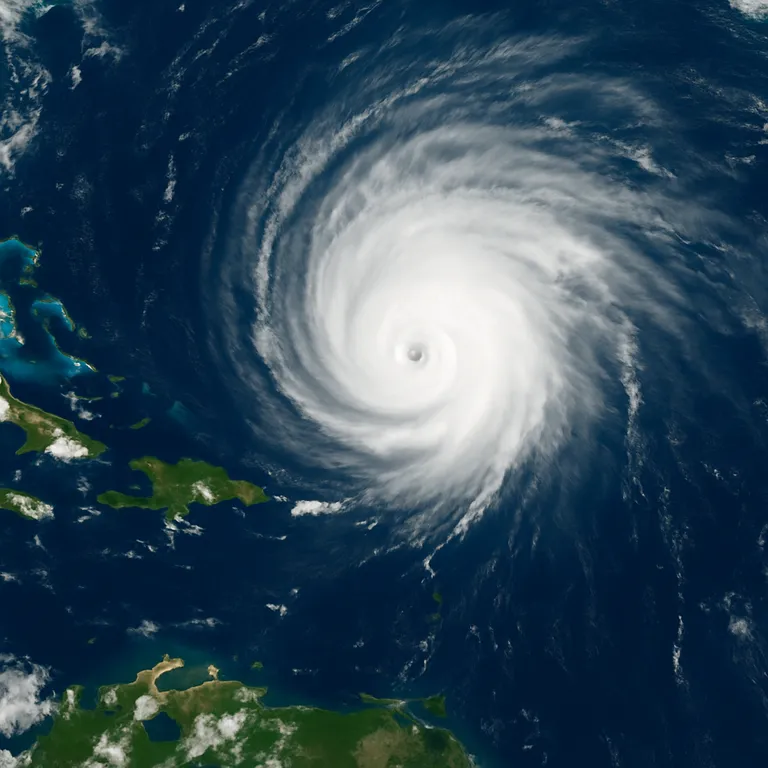
Hurricane Erin has rapidly intensified into a Category 4 hurricane in the Atlantic, packing sustained winds of 130 mph as of Saturday morning, according to the National Hurricane Center (NHC).
The powerful storm is currently located about 150 miles northeast of Anguilla, churning rough seas and sending heavy rain and gusty winds across nearby islands.
Caribbean Islands Brace for Impact
While Erin is expected to pass just north of the Leeward Islands, the Virgin Islands, and Puerto Rico, tropical alerts remain in effect for parts of the region. These alerts warn of:
- Heavy rainfall and localized flooding
- Gusty winds impacting coastal areas
- Rough surf and hazardous marine conditions
Officials stress that even without direct landfall, the hurricane poses serious risks for maritime travel and coastal communities.
Forecast Path: Northward Turn Expected
Forecasters say Erin is gradually turning northward and is likely to track over the western Atlantic next week. Current projections suggest it will remain away from the U.S. mainland and Bermuda, but officials caution that shifts in the storm’s track are possible.
“Any sharp deviation east or west could alter risks for the U.S. East Coast and Bermuda,” the NHC warned.
Ripple Effects Beyond the Caribbean
Even if Erin stays offshore, its presence will generate:
- Rough surf across the western Atlantic
- Dangerous rip currents along beaches in the U.S. and Bermuda
- Heightened risks for shipping and aviation routes
Final Thoughts
Hurricane Erin’s rapid intensification underscores the volatile nature of this year’s Atlantic hurricane season. Residents in affected regions are urged to monitor official updates closely and exercise caution near coastal waters.
As Erin churns northward, the storm serves as another reminder of the growing frequency and strength of major hurricanes in the Atlantic basin.
By ✍️ Yorlinda Ramìrez - MicuPost Team
🔍 Sources:
Published by MicuPost – Reporting storms that shape the world.